Precision Aerial Surveys and Advanced Media Capture in Wichita
Precision Aerial Observation for Kansas
Wichita Helicopter Charters offers comprehensive aerial survey capabilities across Kansas, leveraging the unique low-altitude and hover proficiencies of rotary-wing aircraft. Our solutions encompass advanced services such as magnetometer and electromagnetic surveys, precise LiDAR data acquisition, and accurate GIS mapping. Furthermore, we specialize in high-definition aerial cinematography and photography. This includes provisioning aircraft for specialized camera mounts or configuring them for door-off operations, facilitating superior handheld capture. For critical data acquisition and visual documentation requirements within the Kansas landscape, our diverse options ensure optimal technical and operational outcomes.
Aerial
Surveys
LiDAR, GIS Maps, FLIR, HD Video & More
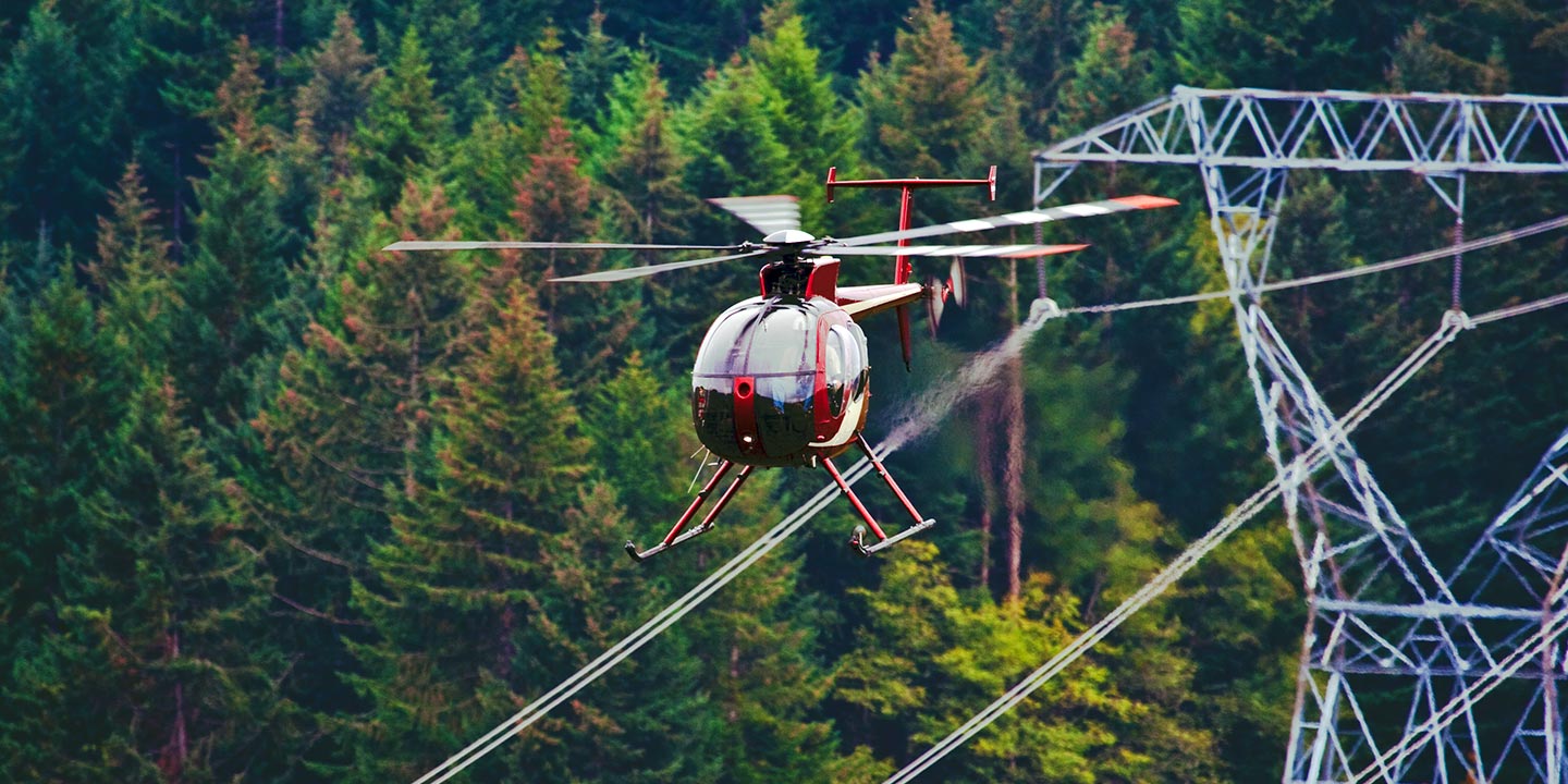
Wichita Helicopter Charters delivers critical aerial support for infrastructure projects. We provide the right aircraft and specialized equipment for precise pipeline surveys, right-of-way inspections, and robust transmission line patrols. Ensure your project is executed with unparalleled accuracy and efficiency across the Kansas utility infrastructure.
High Tech Results
The Top Pilots in Kansas, Today's Technology... Maximum Results.
Call 1-866-826-4826 Now!
Wichita Helicopter Charters provides the tools needed to complete your land surveys, utilizing the right equipment to provide the aerial photos that are often needed.
Effective aerial surveys are pivotal for critical right-of-way and site inspections, precise topographical data acquisition, and high-definition commercial imaging. Rotary-wing aircraft offer the superior platform for detailed assessment of Kansas terrain, facilitating pipeline leak detection, transmission line anomaly identification, and comprehensive property documentation. Wichita Helicopter Charters specializes in developing bespoke photographic and remote sensing operations. These solutions are meticulously customized to maximize both technical precision and financial efficiency, ensuring optimal project outcomes for diverse commercial requirements throughout the region.
For precision aerial surveying, the helicopter stands as the optimal platform due to its unique flight envelope. Unlike fixed-wing aircraft, which are generally restricted by FAA regulations to a minimum of 1,000 feet above obstacles, rotary-wing aircraft can operate at significantly lower altitudes and at reduced airspeeds. This capability allows for highly detailed data capture and thorough inspection of critical infrastructure or environmental features. Furthermore, helicopters provide access to otherwise inaccessible or hazardous zones, furnishing engineers and project managers with invaluable perspectives for comprehensive analysis across Kansas.
There is no better way to conduct your visual survey, animal population counts, soil drainage analysis, ROW inspections, pipeline and transmission line inspections, and geographical surveys.

LiDAR Imaging
Light Detection and Ranging, or LiDAR, is a remote sensing method used to examine and measure Kansas topography as well as objects, like vegetation, upon it.

Infrared Imaging
Thermographic IR cameras are used to detect radiation in the long-infrared range of the electromagnetic spectrum and produce images of that radiation, called thermograms.

HD Video Gimbal Capture
Modern HD and 4K cameras can be mounted to helicopters, using the proper STCs, with a gimbal to stabilize photos & videos for detailed results.
Strategic Aerial Cinematography and Professional Videography
For expert camera work in the Wichita Sky
Get a Fast, free QuoteWichita Aerial Cinematography
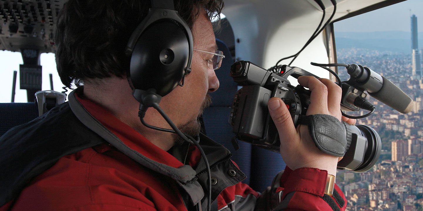
Wichita Helicopter Charters provides unparalleled access to professional-grade aerial cinematography resources throughout Kansas. We facilitate custom shoots utilizing the industry's most advanced gyro-stabilized camera mounts, including Tyler Mounts, Wesscam, Cineflex, Pictorvision, and SpaceCam. These systems integrate seamlessly with specialty cameras such as Cineflex HD, RED Epic, Arri Alexa, and even experimental 3D camera configurations, ensuring technical superiority for any production. Our capabilities extend to supporting diverse production goals, from dynamic air-to-air sequences to precise ground-to-air perspectives. We specialize in provisioning helicopters optimally configured for both still and motion photography, addressing virtually every media-related operation within Kansas. This includes high-impact filming for feature films, television series, documentaries, promotional videos, and commercials. Furthermore, we support complex aerial prop requirements, critical relief work for broadcast networks, and comprehensive event coverage for historical or major sporting events. Our collaborative approach ensures the rotary-wing platform aligns perfectly with your aerial Director of Photography's vision, consistently delivering exceptional visual results across all media applications in the region.
Call Us Today at 1-866-826-4826 for a Free Quote
Contact Us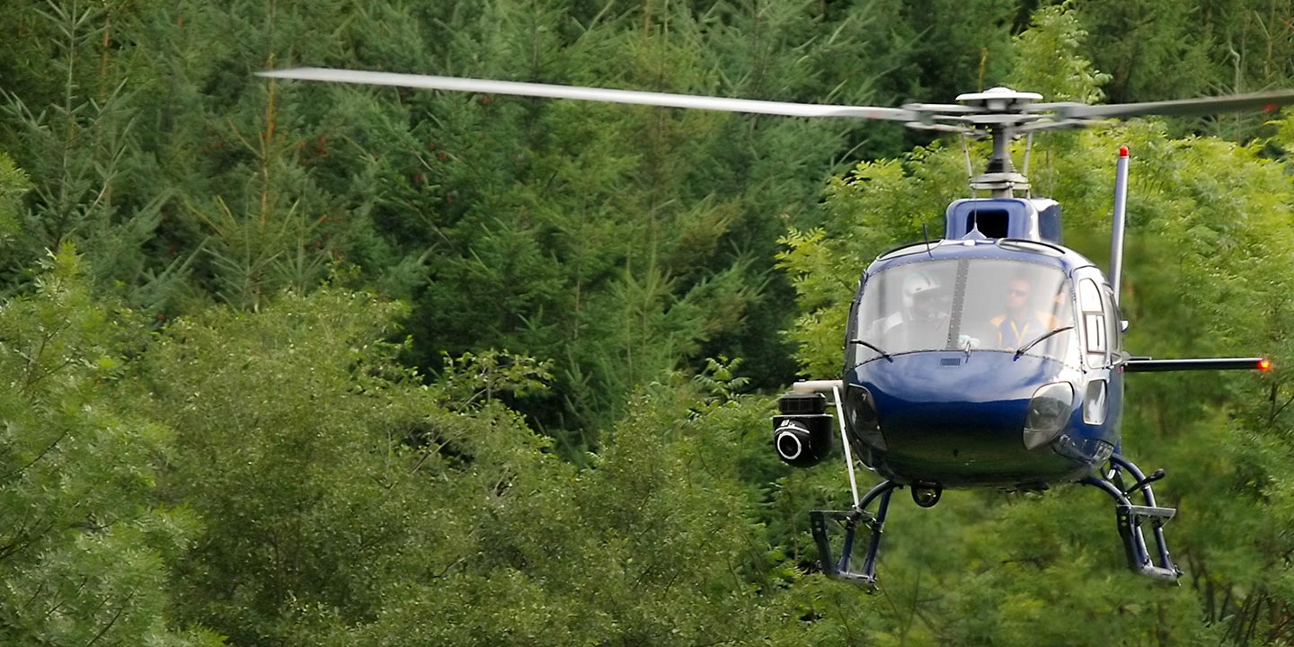
Aerial Photos
Hand-held or Mounted OpTions in Wichita
We will help you get the right equipment for your aerial photography project! Call 1-866-826-4826 today to get a fast, free quote.
The Most Options for Photography
Capturing the distinct landscape and architectural features of Kansas requires an elevated perspective, optimally provided by aerial platforms. Wichita Helicopter Charters facilitates bespoke aerial photography charters, meticulously engineered to achieve your precise visual objectives. We offer diverse helicopter configurations, including aircraft with removable doors for dynamic handheld capture, alongside advanced gyro-stabilized mounts for superior image stability and precision. These technical options ensure professional-grade results for projects spanning environmental documentation to commercial advertising. We are committed to providing cost-effective photographic solutions that deliver exceptional visual fidelity across the Kansas region, enabling the realization of complex creative and technical visions.
Superior Service
Every one of our customers gets a dedicated helicopter expert to assist with flight plans, tech loadouts, production logistics, project schedules, and other demands.
Over 500 Aircraft
Our network of direct air partners extends well beyond Wichita, Kansas. This allows us to offer a wide range of solutions for even the most sophisticated projects.
The Best Equipment
From high-tech sensors like LiDAR, FLIR, and GIS to HD cameras and movie production gimbals, we're here to make your job as easy as possible.